
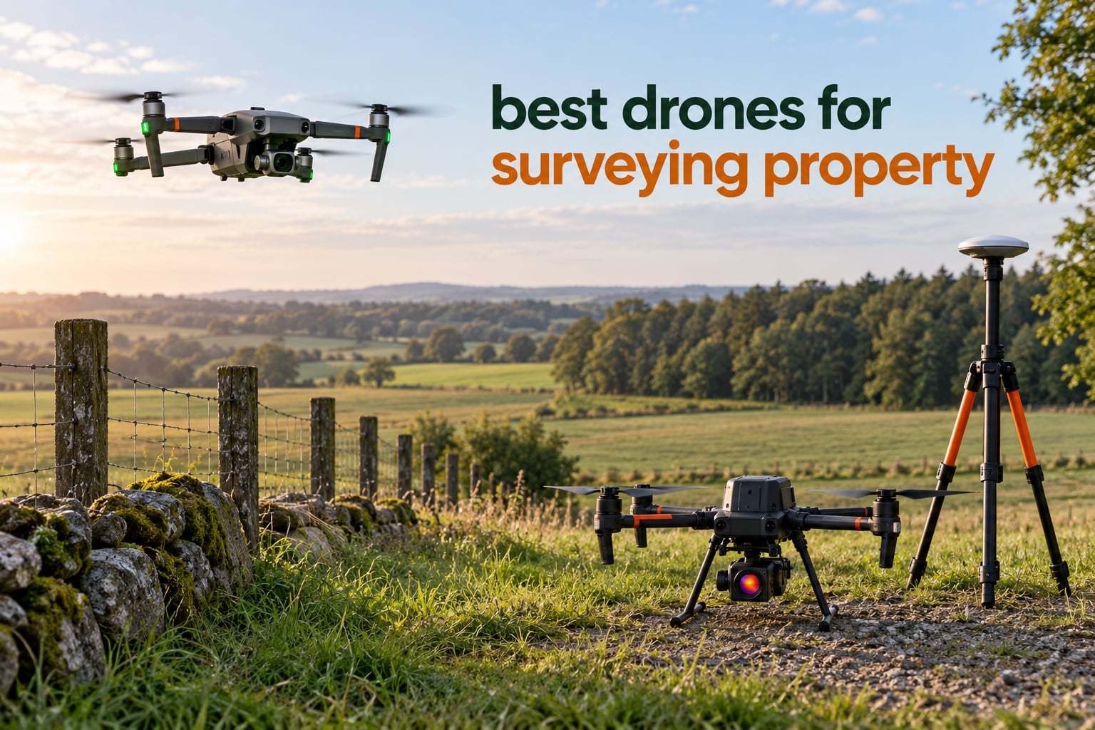
Short answer: the Autel EVO II PRO RTK V3 is the best-value pick for most people surveying property, because it is one of only two aircraft in this roundup with an onboard RTK receiver, a 1-inch 6K camera with a mechanical shutter, and enough owner feedback (19 reviews) to know how it behaves in real wind. Everyone else in the list is a thermal or inspection platform first and a mapping platform second.
That distinction matters more than any spec on a spec sheet. A drone that can read a roof temperature at 30 metres is not the same machine as one that can put a fence line in the right coordinate system. Before you compare cameras, coverage or flight time, you have to decide whether you need photogrammetry, LiDAR, or thermal.
So here is the honest framing. If you are buying or selling land, verifying acreage, checking a boundary dispute, or documenting a parcel before development, you want an RTK-equipped multirotor with a mechanical shutter and a repeatable mission mode. If you are inspecting roofs, finding heat loss, or documenting a site for a listing, a dual thermal and visible camera matters more than GNSS centimetres. If you are mapping 40 hectares of open ground, you are already past the point where a multirotor is the right tool.
This roundup covers seven aircraft that are realistically available to property professionals today, and it is written for the buyer who is not flying survey missions every week. We looked at published accuracy figures, sensor specs, coverage claims, review data and the software each one hands you.
One more thing to set expectations early. Of the seven drones below, only two carry a true RTK receiver. The rest rely on GNSS positioning without real-time correction, which means their accuracy depends almost entirely on ground control points you place and measure yourself. That is not a dealbreaker for many jobs, and we explain where it matters and where it does not in the buying guide.
Before we get into the aircraft, if your interest is broader property upkeep rather than mapping, our guide to chainsaws for property maintenance covers the ground-clearing side of getting a parcel flight-ready.
Table of Contents
- Top 3 Picks for Surveying Property in 2026
- Every Drone in This Roundup Compared Side by Side
- 1. Autel EVO II PRO RTK V3 for Accurate Mapping on a Single Airframe
- 2. Autel EVO II Dual 640T V3 for Thermal Property Inspections
- 3. Autel EVO Lite 640T Enterprise for Lightweight Single-Pilot Deployments
- 4. Autel EVO II Dual 640T RTK V3 for Thermal and RTK in One Airframe
- 5. Autel EVO MAX 4T V2 for Four Sensors in One Gimbal
- 6. DJI Matrice 4TD for All-Weather Enterprise Surveying
- 7. DJI Mavic 2 Pro Enterprise Bundle for Listing Documentation
- How to Choose a Drone for Surveying Property
- Can You Legally Survey Your Own Property With a Drone?
- What a Survey Drone Actually Costs to Run
- Frequently Asked Questions
- The Bottom Line for Surveying Property in 2026
Top 3 Picks for Surveying Property in 2026

Autel EVO II PRO RTK V3
- Onboard RTK with 1 cm + 1 ppm accuracy
- 1 inch Sony 6K camera with mechanical shutter
- 38 minute flight time
- PPK and NTRIP supported

Autel EVO II Dual 640T V3
- 640x512 thermal sensor at 30 fps
- 50MP RYYB visible camera
- 38 minute flight time
- Carbon fiber body with 3 batteries

Autel EVO Lite 640T Enterprise
- Only 866 g and folds to 210mm
- 40 minute flight time
- 640x512 thermal plus 48MP visible
- Enterprise app with repeatable missions
If you want the short version: the EVO II PRO RTK V3 for accurate mapping, the EVO II Dual 640T V3 for thermal and property inspection work, and the EVO Lite 640T Enterprise if sub-900-gram handling matters more than sensor size. Everything else in the list is a specialist or a compromise.
Every Drone in This Roundup Compared Side by Side
| Product | Specifications | Action |
|---|---|---|
| Autel EVO II PRO RTK V3 |
|
Check Latest Price |
| Autel EVO II Dual 640T V3 |
|
Check Latest Price |
| Autel EVO Lite 640T Enterprise |
|
Check Latest Price |
 Autel EVO II Dual 640T RTK V3 Autel EVO II Dual 640T RTK V3 |
|
Check Latest Price |
 Autel EVO MAX 4T V2 Autel EVO MAX 4T V2 |
|
Check Latest Price |
 DJI Matrice 4TD DJI Matrice 4TD |
|
Check Latest Price |
 DJI Mavic 2 Pro Enterprise Bundle DJI Mavic 2 Pro Enterprise Bundle |
|
Check Latest Price |
Two columns in that grid deserve attention before anything else. The RTK column matters enormously for survey accuracy, and it is sparse. The thermal column matters enormously for property condition work, and it is nearly universal. That is the shape of the market right now: accurate mapping hardware and thermal inspection hardware have barely merged.
1. Autel EVO II PRO RTK V3 for Accurate Mapping on a Single Airframe
Autel Robotics EVO II PRO RTK V3 w/Real-time Centimeter-Level Positioning
1 inch Sony 6K camera
RTK and PPK with base station
38 min flight time
9.32 mile range
Pros
- Real-time centimeter-level RTK positioning
- No ground control points needed with PPK and time sync
- Excellent stability in heavy wind
- Strong consistent control link
- Useful with Pix4D for orthoimagery and 3D models
Cons
- Autel app interface is not intuitive and settings are hard to find
- Limited official tutorials compared with DJI
- Colours come out somewhat oversaturated
This is the one we keep coming back to. The RTK module is integrated into the aircraft rather than bolted on, which means the correction data is logged on board during the flight instead of reconstructed afterwards. Pair it with a base station or an NTRIP network and you get 1 cm + 1 ppm horizontal accuracy without walking the property with a survey staff.
The camera is the part that decides whether the accuracy is useful. A 1-inch Sony sensor shooting 6K stills with a mechanical shutter means no rolling-shutter distortion when the aircraft yaws during an oblique pass. That matters because warped edges in a photogrammetry block translate directly into warped coordinates at the corners of your parcel.
Owners consistently single out two things in the reviews. The first is wind stability, which is the single most important physical characteristic for survey work because a survey-grade flight has to hold position and gimbal angle precisely. The second is the link quality, which reviewers describe as strong and consistent rather than adequate.
The software side is where this drone earns its place. It flies rectangular, polygon and waypoint missions, saves flight profiles for repeat visits to the same parcel, and hands geotagged images straight into Pix4D or Agisoft Metashape. If your workflow is capture now and process later on the desktop, this fits cleanly.
One Autel-specific warning from the user base: the Autel app is the weakest link. Settings for RTK base station pairing, mission overlap and GSD are buried, and Autel publishes fewer tutorials than DJI. Budget an afternoon with the manual before your first survey flight rather than on the day of the job.
Reviewers also report colour rendering that runs oversaturated, which is a smaller issue than it sounds because photogrammetry software works from raw geometry rather than final colour. It does matter if you are also producing client-facing orthomosaics, because you will be colour-correcting before delivery.
When this is the right aircraft for your parcel
Choose the EVO II PRO RTK V3 when the deliverable is geometry: acreage, boundary evidence, a topographic surface model, a stockpile volume, or a set of graded plans for a small site. It is the only aircraft here that lets you skip ground control entirely and still finish with centimeter-class output.
It also handles the awkward property cases well. 38 minutes of flight time covers roughly 20 hectares per sortie at survey overlap and altitude on open ground, and the 9.32-mile link range means you do not have to sit on the property boundary to keep the aircraft connected.
A 5000mAh battery and a fast charge cycle matter more than people expect when you are covering a parcel with trees, a slope and a pond. Every extra battery in the box is another pass you do not have to schedule around a meeting.
When this is the wrong aircraft for your parcel
Skip it if your job is thermal. There is no thermal sensor on this aircraft, and adding one is not an option because the gimbal is fixed. That is the trade you make for the mechanical shutter and the integrated RTK: specialisation in one direction, not versatility.
It is also the wrong choice for dense woodland. Photogrammetry needs to see the ground, and a single 6K camera over a mature canopy will produce a surface model of treetops, which is not what you want if you are checking drainage or slope on a wooded parcel.
Finally, budget for the software and the ground time even though you can fly without control points. RTK without checkpoints is unverified RTK, and the checkpoints that prove your accuracy took from survey monuments or benchmark marks are what make the deliverable defensible later.
2. Autel EVO II Dual 640T V3 for Thermal Property Inspections
Autel Robotics EVO II Dual 640T V3, 640×512 Thermal Imaging Drone, RemoteID
640x512 thermal at 30 fps
50MP RYYB visible camera
38 min flight time
Carbon fiber, 2.5 lb
Pros
- Excellent 640x512 thermal detail with useful temperature analysis
- 50MP visible camera on a large RYYB sensor
- Precise landing within about 2 feet
- 38 minute flight time and 15km transmission
- Strong customer service and warranty support reported
Cons
- Thermal camera failure reported after about a year of use
- Extended warranty plan costs extra
- Case vent and camera cover attachment point is a reported weak point
This is the most reviewed aircraft in the roundup at 53 reviews, and the feedback pattern is unusually consistent. Buyers talk about thermal detail first, then about how stable the aircraft feels and how accurately it lands, which tells you it is flown by people who are actually working rather than testing on day one.
The thermal sensor runs at 640 by 512 at 30 frames per second through a 13mm lens with 16x digital zoom. That is not a thermal camera for finding a missing dog. It is a thermal camera for spotting heat loss at roof edges, water intrusion under a slab, and failing HVAC units across a large parcel.
The visible camera is the sleeper feature here. A 0.8-inch CMOS sensor at 50MP with an RYYB colour filter gives you usable imagery for the same flight, and the picture-in-picture thermal overlay means one pass captures both the visual and thermal record. For property due diligence that halves your flight count.
Detection, recognition and identification ranges are calculated out to 100 metres, and there are 10 or more thermal palettes plus free infrared analysis software on the card. In practice that is enough to hand a client a legible heat map without paying for a subscription tool.
The honest weakness is longevity. At least one owner reported the thermal camera failing after roughly a year, with a water damage claim that was disputed. With a 53-review sample that is a single report rather than a pattern, but on an aircraft of this type it is the first thing to test in the first 30 days.
Two other practical notes from the reviews. The case vent and camera cover attachment point has cracked for some owners, which matters because the case travels. And the extended warranty plan is a paid add-on rather than standard coverage, so price that into your decision.
When this is the right aircraft for your parcel
Choose the Dual 640T V3 when your client needs evidence of physical condition rather than just geometry. Roof inspections, thermal envelope assessments, moisture intrusion surveys and pre-purchase building checks all sit here, and the 50MP visible camera covers the documentation photography at the same time.
It is also a strong companion for any job where the deliverable has to be reviewed by people who are not technical. A paired visual and thermal orthomosaic is far easier for an owner or a buyer to interpret than a bare point cloud, and this aircraft produces both in one flight.
The 38-minute flight time and 15km tri-band transmission give you comfortable coverage on parcels with mixed terrain. Carbon fiber construction and 2.5 pounds total weight keep it transportable in a small vehicle, which matters if you are driving to sites rather than based at one location.
When this is the wrong aircraft for your parcel
There is no RTK on this model, so do not buy it for boundary or cadastral work expecting centimeter accuracy. The 50MP rolling-shutter visible sensor will produce photogrammetry, but you will be relying on ground control points alone to georeference it, and you will need more of them than you would with an RTK airframe.
It is also the wrong choice if you plan to grow into LiDAR or multispectral work later. The gimbal is fixed and there are no accessory expansion ports outside the Enterprise series, so the payload ceiling on this aircraft is what it shipped with.
If your work is on wooded ground, expect the same canopy problem as any photogrammetry platform, and note that the thermal channel will be your most reliable output there because heat signatures at the forest edge still read through gaps in the canopy.
3. Autel EVO Lite 640T Enterprise for Lightweight Single-Pilot Deployments
Autel Robotics EVO Lite 640T Enterprise Bundle, 866g Lightweight
866 g foldable body
640x512 thermal plus 48MP visible
40 min flight time
Thermal range -20C to 550C
Pros
- Lightest aircraft here at 866 g with a compact foldable footprint
- Longest flight time in the lineup at 40 minutes
- 640x512 thermal with 550C upper range
- Single-person deployment from a small vehicle
- Enterprise app supports repeatable professional missions
Cons
- Plastic construction rather than carbon fiber
- Lower transmission range at 12km versus 15km
- Consumer-grade controller instead of Smart Controller V3
This is the aircraft you carry rather than wheel around. At 866 grams it folds to 210 by 123 by 95 millimetres, which means it fits in a backpack and can be deployed by one person walking a boundary rather than one person driving to a launch point and another flying.
You give up carbon fiber for plastic, and you get 40 minutes of flight time, which is the longest in this lineup. That combination matters for a single-pilot operator covering scattered parcels, where every gram in the pack and every minute of endurance reduces the friction between jobs.
The imaging stack is a 640 by 512 thermal camera at 30 Hz with a 9mm lens plus a 1/2-inch 48MP visible sensor. Temperature measurement runs from minus 20 to 550 degrees with stated accuracy of plus or minus 3 degrees, which covers building envelope and roof inspection work comfortably.
Autel also puts AI target recognition on this model, with self-learning and over 100 tracked targets placed on a digital map. Reviewers find it genuinely useful for single-pilot repetitive inspection work rather than a gimmick, particularly when you are scanning multiple similar structures in one pass.
When this is the right aircraft for your parcel
Choose it if you are a one-person operation moving between small jobs, or if the property is large enough that you need to walk the site and relaunch rather than commit to one long battery. Forty minutes of endurance and a 1.9-pound aircraft is a difficult combination to argue with for accessibility work on steep or awkward ground.
It is also the cheapest way into a dual thermal and visible workflow in this roundup, and the foldable body means storage is not the problem it is with enterprise platforms. If you are in a rented office or share a vehicle with other equipment, that matters.
For inspection work where you need to spot and then confirm a target visually, the combination of AI recognition, thermal palettes and a 48MP visible camera handles detection, confirmation and documentation in a single flight line.
When this is the wrong aircraft for your parcel
It is the wrong tool for survey-grade geometry. There is no RTK receiver, no PPK workflow and no mechanical shutter, so every photogrammetric job depends on ground control points, and a plastic airframe is more likely to flex or drift after a season of field use.
The controller is a real limitation. The consumer-grade controller with a smaller, less weather-protected screen is harder to read in full sun than the 2000-nit Smart Controller V3 on the other Autels, and field mapping is a full-sun activity.
Be cautious about longevity conclusions generally. Seven reviews is a thin sample, and the rating distribution has a noticeable share of three-star scores. If you are buying for years of daily work rather than occasional use, one of the more heavily reviewed airframes is the safer assumption.
4. Autel EVO II Dual 640T RTK V3 for Thermal and RTK in One Airframe
Autel Robotics EVO II Dual 640T RTK V3, 640T w/Centimeter-Level Positioning
640x512 thermal at 25 Hz
1cm + 1ppm RTK accuracy
15km tri-band SkyLink
Smart Controller V3
Pros
- Centimeter RTK paired with a thermal sensor in the same airframe
- NTRIP network
- base station and PPK correction sources supported
- 640x512 thermal at 25 Hz with 13mm lens
- 2000-nit 7.9 inch controller readable in direct sun
- Free IR PC analysis tool included
Cons
- Only one review available so long-term reliability is unproven
- Highest tier cost of the Autel EVO II models listed
- Advanced features carry a real learning curve
This is the specification combination most survey buyers actually want and rarely find: a 640 by 512 thermal sensor alongside a real-time RTK receiver with 1 cm + 1 ppm horizontal and 1.5 cm + 1 ppm vertical accuracy. You can capture thermal evidence and georeferenced imagery in one flight, and the coordinates on the thermal frame will be defensible.
Correction sources are flexible. It accepts NTRIP network corrections, Autel base stations and PPK post-processing, so you are not locked into buying a base station if a survey monument nearby already has one, or if a network correction service covers your area.
The Smart Controller V3 with a 7.9-inch 2000-nit display is rated IP43, and on a mapping job that display brightness is not a luxury. Reviewers of the sibling models repeatedly note that screen brightness in sunlight is what separates a smooth field day from a frustrating one.
SkyLink 2.0 gives 15km transmission on tri-band 2.4, 5.8 and 900MHz with anti-interference capability. The 900MHz band is the one that carries further and holds up better near structures and power infrastructure, which is exactly the environment of a developed parcel.
When this is the right aircraft for your parcel
Choose it when the deliverable has to satisfy both a mapping requirement and a condition requirement. Building envelope analysis with georeferenced thermal frames, or a pre-construction condition record that will be compared against a post-construction survey, are the jobs this solves and a single-sensor drone cannot.
It is also a strong choice where terrain or structures limit launch positions. The 15km link and 360-degree obstacle avoidance give you more freedom to fly from a safe spot with a clear line of sight rather than from the ideal point on the parcel.
If you already run Autel Enterprise workflows, the thermal palettes, measurement modes and free IR analysis tool drop into an existing pipeline with no new software subscription to justify.
When this is the wrong aircraft for your parcel
The obvious caution is the review data. A single 5-star review is a good sign and not a reliability dataset, so treat the specifications as the pitch and insist on a return window and a documented support path before committing a project budget to it.
It is also more airframe than many property jobs need. If your work is purely photogrammetric on open ground, a mechanical-shutter RGB camera with RTK is a better use of money than a thermal sensor you will use twice a year.
On very large parcels, keep the endurance math realistic. Thermal plus a heavy gimbal and a full battery still means planning multiple flights, and there is no fixed-wing option in this roundup if you need to cover open ground at scale.
5. Autel EVO MAX 4T V2 for Four Sensors in One Gimbal
Autel Robotics EVO MAX 4T V2 With 4 Cameras in One
Wide, zoom, thermal and laser rangefinder
48MP stills, 8K video
42 min hot-swap batteries
2.4 lb aircraft
Pros
- Four sensors in one gimbal including a 640x512 thermal and a laser rangefinder
- 720 degree obstacle avoidance using vision plus millimetre-wave radar
- Hot-swappable batteries with in-place detection and 42 minute endurance
- Triple anti-jamming covering radio interference
- EMI and GPS spoofing
- A-Mesh networking for multi-aircraft operations
Cons
- Only 2 reviews so long-term reliability is unproven
- Steep learning curve across four sensor workflows
- Enterprise-focused and more airframe than basic survey work needs
The EVO MAX 4T V2 solves a specific problem: getting a laser rangefinder, a thermal camera and a proper zoom into the same flight. The laser rangefinder reads from 16.4 to 3737 feet with accuracy of plus or minus one metre plus 0.15 percent of distance, which is enough to set out stake points and check setbacks without a separate measuring tool.
The 48MP half-inch wide camera with max ISO 64000 and the Moonlight 2.0 algorithm handle the low-light and dusk flights that show up constantly on evening site visits. The 48MP zoom camera gives 10x optical and up to 160x digital, which is useful for reading signage and structure details from a safe standoff distance.
Two engineering features deserve more attention than marketing usually gives them. Hot-swappable ABX41-D batteries with in-place detection mean you swap power without rebooting the aircraft, which removes the cold-start delay on multi-flight days. And triple anti-jamming resistance to radio interference, EMI and GPS spoofing is not paranoia when you fly near power infrastructure.
A-Mesh 1.0 networking lets several aircraft share position and task data, which is how teams run coordinated multi-aircraft surveys of a single large parcel. The 720-degree obstacle avoidance combines dual fisheye vision with millimetre-wave radar for the blind zones that pure vision systems miss.
When this is the right aircraft for your parcel
Choose it when a single sortie has to serve several masters. A pre-purchase inspection that needs roof thermal imagery, structural photos from a safe distance, and actual measurements for a report is one flight with this aircraft and three visits with a single-sensor drone.
It is also the strongest choice here for evening and low-light work, for sites with heavy electromagnetic interference, and for anyone planning to grow into multi-aircraft operations later, since A-Mesh is already built in.
GPS-denied navigation and auto path finding help on parcels where trees, buildings or terrain degrade the GNSS signal, which is a common and underappreciated failure mode on wooded properties.
When this is the wrong aircraft for your parcel
Two reviews is not enough to project a service life, and a four-sensor platform has four ways to develop a fault. If your work is steady and predictable rather than varied, a simpler airframe with a proven track record is usually the better business decision even though it does less.
The complexity is real. Advanced Autonomy, auto path finding, dynamic tracking and four sensor workflows each take time to learn properly, and crews under time pressure tend to fall back to manual flight, which is where the extra hardware stops paying for itself.
Weight is worth noting at 2.4 pounds for the aircraft. It is still portable, but it is at the upper edge for one-person field deployment, and the 42-minute endurance figure assumes the standard battery rather than a payload add-on.
6. DJI Matrice 4TD for All-Weather Enterprise Surveying
DJI Matrice 4TD Quadcopter with RC Plus 2 Enterprise, Thermal, Wide & Tele Lenses, Laser Range Finder, Low-Noise Anti-Ice Propellers, IP55
Wide, tele, thermal and laser rangefinder
IP55 sealed, anti-ice propellers
RC Plus 2 controller
Pros
- IP55 weather sealing with low-noise anti-ice propellers for rain and freezing conditions
- Complete triple-lens visual
- thermal and laser rangefinder suite
- Around 35 minutes of real battery life reported in 20 to 30 mph gusts
- DJI FlightHub 2 and Dock 3 integration for automated operations
- NIR illumination light supports low-light work
Cons
- Very heavy at 10 pounds and not portable
- DJI Care is not offered in the US
- Enterprise dealer channel rather than direct support for better service terms
The Matrice 4TD is the only aircraft here rated IP55, and that single fact changes what kind of job you can accept. Rain, dust and freezing temperatures are the difference between capturing a parcel on the day you inspect it and rescheduling for the next fair week, which on a property transaction is often not a choice at all.
The low-noise anti-ice propellers matter for a second reason: noise. Neighbouring properties are close, and a quieter aircraft reduces the chance of a privacy complaint during a flight over a shared parcel boundary.
Owners report roughly 35 minutes of real-world battery life in 20 to 30 mph gusts, which is notably better than the quoted figure would suggest and is a function of the airframe being designed for load rather than for being carried. Low noise and long endurance in wind is exactly the combination survey work needs.
Dock 3 compatibility and FlightHub 2 integration put this aircraft into the automated and remotely supervised category. If you are mapping a large portfolio repeatedly, an aircraft that can operate from a fixed point without a pilot standing on the parcel changes the economics more than any camera upgrade.
When this is the right aircraft for your parcel
Choose it for scheduled, repeated work in variable weather, for large portfolios mapped on a timetable, or for any job where a missed window has a real cost. Weather resilience is not a feature you notice until the first time it saves a reschedule.
The triple-lens array with thermal and a laser rangefinder covers inspection and mapping in one sortie, and the NIR light extends low-light capability beyond what a standard RGB camera delivers at dusk.
If you run or are evaluating a dock-based operation, this is the aircraft in the list designed for it. The 10-pound weight is a deliberate trade that assumes the aircraft lives at a base rather than travelling to a job.
When this is the wrong aircraft for your parcel
It is wrong for a homeowner or a small operator working one parcel at a time. At 10 pounds it needs a vehicle to reach the site and a case to survive in, and none of that mass is helping you map a residential lot.
Support is also a genuine factor. DJI Care is not available in the US, and the reported experience points to buying through an enterprise dealer for better service terms rather than through a general marketplace listing, which is worth doing if you choose this aircraft.
Two reviews is a thin evidence base on an aircraft this expensive, and the pricing spread between channels is significant. Get a written quote from a dealer, confirm the support path, and test the accessory ecosystem before committing.
7. DJI Mavic 2 Pro Enterprise Bundle for Listing Documentation
DJI Mavic 2 Pro Enterprise Bundle
Hasselblad 1 inch 20MP sensor
31 min flight time
907 g takeoff weight
3-axis gimbal
Pros
- Hasselblad L1D-20c 1 inch sensor produces genuinely usable imagery for property documentation
- Lightest and most portable airframe in the roundup at 907 g
- 31 minute flight time and 44 mph maximum speed
- Adjustable aperture for controlling depth of field on exteriors
- Enterprise bundle includes a 32GB card and reader
Cons
- No RTK positioning at all
- Older Mavic 2 platform with a dated sensor generation
- Video limited to 1080p
Let us be direct about where this aircraft sits. It is not a survey drone. There is no RTK receiver, no PPK workflow and no thermal sensor, and if you need centimeter accuracy you will be building a ground control network with a conventional receiver and measuring every point yourself.
What it does have is the best large-sensor camera per pound in this roundup. The Hasselblad L1D-20c with a 1-inch 20MP CMOS sensor, an adjustable aperture from f/2.8 to f/11, and a 3-axis gimbal produces images that look like they came from a much more serious camera.
That is why it earns a place. Real-estate agents documenting a listing, brokers who need a consistent visual record of a parcel before it goes to market, and anyone shooting aerial context for a marketing package get results here that a thermal inspection drone will never deliver.
At 907 grams with 31 minutes of flight time, it is also the easiest aircraft here to fly for someone who is not a full-time pilot. Omnidirectional obstacle sensing handles the trees and eaves that make property flights stressful, and the 8GB internal storage plus SD card support means you are not relying on a single card.
When this is the right aircraft for your parcel
Choose it when the output is a photograph rather than a measurement. Listing imagery, marketing context shots, construction progress documentation where visual comparison over time is the goal, and due-diligence photo sets all sit squarely in its capabilities.
It is also the lowest-friction way to start. Small, light, forgiving to fly, and it needs no base station, no network corrections and no ground control workflow to produce a usable result on the day you bought it.
For a homeowner flying their own property once, this kind of aircraft plus a photogrammetry subscription is often a more rational purchase than an RTK platform, provided the output is for your own understanding and not for a legal record.
When this is the wrong aircraft for your parcel
It is the wrong choice the moment anyone asks for coordinates. Without GNSS correction or ground control, absolute accuracy on a parcel is measured in metres, and no amount of post-processing changes that fundamental limit.
The platform is also old. 1080p video, a 20MP sensor generation and a design now several product cycles behind current hardware mean you are buying into an ecosystem that will not receive meaningful updates.
If you want to grow from photography into mapping without changing aircraft, this is the wrong starting point. Buy a current-generation RTK platform now, or buy a thermal platform, and treat photography as a secondary capability you can build on later.
How to Choose a Drone for Surveying Property
The wrong question is which drone is best. The right question is which sensor and which airframe match the deliverable you have to hand a client, a title company or a county. Here are the five decisions that actually determine whether you bought the right machine.
Photogrammetry, LiDAR or thermal
Photogrammetry is the default for most property work. It is fast, cheap to process, and produces orthomosaics, point clouds, digital terrain models and digital surface models that almost every downstream tool accepts. It needs open sky, which is its one hard limitation.
LiDAR is the answer for wooded terrain, dense vegetation and any site where you need a bare-earth surface model under a canopy. Several returns per pulse let it pick out the ground beneath trees. The trade is that LiDAR gives you geometry, not colour, and it costs considerably more in sensors, airframes and processing time.
Thermal is a condition tool, not a mapping tool. It tells you about heat, moisture and energy loss. Pair it with RGB and you have a building inspection package; fly it alone and you have a heat map.
RTK, PPK, and why ground control still matters
RTK corrects the aircraft position in real time during the flight. PPK logs raw GNSS data and corrects it on the computer afterwards, which is more forgiving of interruptions but depends on unbroken logging. Network RTK uses a correction service over the internet. PPK works anywhere. A base station works anywhere you can set one up.
The practitioner rule of thumb, and the most repeated point across mapping forums, is that accuracy is only ever as good as your ground control. RTK removes the need for control points on most jobs, but checkpoints are still what prove the result. Survey at least four checkpoints you did not use to adjust the model, and report accuracy against them rather than against the software’s own estimate.
Multirotor or fixed-wing
A multirotor hovers, which is what makes oblique and repeat-pass capture possible. Practitioners report roughly 200000 square metres of usable coverage per flight on open ground at survey overlap, so a 20-hectare parcel is a comfortable single-sortie job and anything past 50 hectares becomes a battery-planning exercise.
A fixed-wing VTOL mapper trades hover capability for endurance and covers open ground several times faster. If your property is large, flat and mostly treeless, a fixed-wing platform is the correct answer and no multirotor in this roundup competes with it.
NDAA and Blue UAS in plain English
NDAA compliance and Blue UAS listing matter when your work touches federal agencies, federally funded projects or defence contractors. Section 848 of the NDAA restricts the supply of certain components from certain entities, which has pushed several manufacturers to publish compliance statements. A Blue UAS listing is the Defense Innovation Unit’s endorsement that a specific model is cleared for sensitive work.
For private property transactions and private development, this filter does not apply to you. For survey firms bidding on public work, it is a hard gate that eliminates most of this roundup, so check the current published status for each model before you bid.
Software and open format export
Ask what the aircraft hands you, not just what it does. Agisoft Metashape with a one-time licence is the most repeated value recommendation from small mapping shops and has a large tutorial base. DJI Terra, Pix4D and Pix4Dmatic sit at the enterprise end. DroneDeploy is the simplest route from imagery to a shareable model.
For anything that has to reach a CAD or GIS team, confirm export to LAS and LAZ point clouds, GeoTIFF orthomosaics, and DXF or GeoJSON vectors, and confirm it loads in the tools your client actually uses. Lock-in disguised as convenience is the most common reason a delivered project gets rejected.
Can You Legally Survey Your Own Property With a Drone?
You can absolutely map your own property with a drone. Flying it, capturing imagery and building an orthomosaic for your own understanding is straightforward. The boundary between that and a survey is where most people get it wrong.
Aerial imagery is a measurement of surfaces, not a determination of ownership. A drone cannot see a property line, a deed reference, an easement or a recorded plat. What it can do is produce the topographic and photographic record that a licensed land surveyor then uses, alongside documents only a surveyor or title company can interpret.
So for a listing, an internal understanding of slope and access, a construction progress record, or estate planning, your own drone work is useful and defensible to yourself. For a boundary dispute, a sale where acreage is disputed, a setback question, or anything that will be recorded at a county recorder, hire a licensed surveyor.
You still need to fly legally regardless of purpose. That means Remote ID compliance, registration where required, airspace authorisation near controlled airspace, and visual line of sight unless you have a waiver. Remote ID support is listed on most of the aircraft here, which is a good sign for where you can fly them without retrofitting.
One more practical point about neighbours. Flying over adjacent property raises privacy questions that vary by state and country, and a courteous flight path that stays over your own parcel costs nothing to arrange and prevents a dispute before it starts.
What a Survey Drone Actually Costs to Run
Hardware is the smallest part of the real outlay, and buyers who focus only on the aircraft price end up with a drone they cannot process data from. Here is what else the budget needs to cover.
Processing software ranges from a one-time Metashape licence for small shops to annual enterprise subscriptions for DJI Terra, Pix4D or Bentley ContextCapture. Solo operators often spend less on software over five years than on one extra battery.
Positioning infrastructure is the item most first-time buyers forget. Network RTK subscriptions cover populated areas with no purchase, but rural parcels usually need an owned base station plus a survey monument, bench mark or point you can tie into, and in some regions that setup costs more than the aircraft.
Batteries are a recurring operational cost with a defined lifespan measured in cycles, not years. Budget for a spare set from the start rather than discovering the limitation during a survey deadline.
Certification and labour set the economics. A Part 107 licence is required for commercial operation, and practitioners report drone survey work billed at roughly 320 per hour in the field and 240 per hour in the office, which is not cheaper than conventional survey labour. The savings come from coverage speed on large parcels, not from cheaper hours.
If you are comparing buying against hiring, do the break-even on job count. A one-off property transaction rarely justifies owning a platform. An agent photographing listings weekly, a contractor tracking volumes on several sites, or a small firm adding aerial data to its services can amortise the equipment across a year of work. If that is not your situation, hire a survey service and spend your time on the client relationship.
Frequently Asked Questions
What is the best drone for surveying property?
For most property work the Autel EVO II PRO RTK V3 is the best-value choice, because onboard RTK plus a 1-inch 6K camera with a mechanical shutter gives centimeter-class photogrammetry without ground control points. If your job is thermal inspection rather than measurement, a dual thermal and visible camera is the better buy.
Can I use a drone to survey my property?
You can map your own property for your own understanding, listing documentation and construction records. You cannot use aerial imagery to establish a boundary. A drone measures surfaces, not ownership, so boundary disputes, acreage disputes and setback questions still need a licensed land surveyor.
Can you do a land survey with a drone?
A drone produces the topographic and photographic record that supports a survey, and it does so far faster than a ground crew on open ground. It does not replace the surveyor, who interprets deeds, plats, monuments and easements. For legally defensible boundary work the drone is an instrument used by a licensed surveyor.
Do I need RTK for a property survey?
RTK makes a survey substantially easier because you can fly without laying and measuring ground control points. Without it you can still achieve usable accuracy using control points and checkpoints, which is a lot more field work and more error-prone. Accuracy is only ever as good as your ground control.
What is the best software for drone mapping?
Agisoft Metashape is the most common recommendation for small operations because of a one-time licence and a large tutorial community. DJI Terra and Pix4D suit enterprise workflows with automated reporting. Confirm any option exports to LAS, GeoTIFF, DXF and GeoJSON before committing.
The Bottom Line for Surveying Property in 2026
If you want one drone for accurate property mapping in 2026, buy the Autel EVO II PRO RTK V3. It is the only entry in this roundup combining onboard RTK, a mechanical-shutter 1-inch camera and a review history deep enough to trust.
If you are inspecting rather than measuring, take the thermal and visible pairing instead, and pick the well-reviewed Dual 640T V3. If you fly alone and carry your kit on foot, the 866-gram EVO Lite 640T Enterprise is the practical answer. Whichever you choose, plan your ground control before your first flight, and remember that a licensed surveyor is still the person who signs the boundary.